README.md 2.0KB
Aruco detector
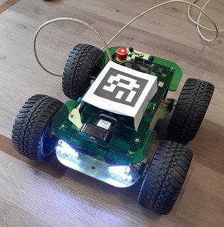
With this ROS2-Node can be determined the pose of different ArUco Markers. The goal of this project was to attach a marker on different robots, and get the absolute positions and orientations via a camera on the ceiling. However, this localization can also be applied to any other arbitary object. This project was created as an project thesis (MSY-Master).
Requirements
Transforms3D
For computing the pose the node requires this library. A detailed description can be found on: https://matthew-brett.github.io/transforms3d/)
pip install transforms3dusb_cam
Usb_cam is a frequently used ros driver for V4L USB cameras. A detailed description can be found here: http://wiki.ros.org/usb_cam
sudo apt get install ros-<ros2-distro>-usb-camImportant: It’s necessary to work with compressed images. Therefor you can use the image_transport library. A detailed description can be found here: http://wiki.ros.org/image_transport
Running the code
For an easy start there is already created a launch file. All required parameters can be set and edited centrally here. The launch-file starts:
- aruco_detector_node
- usb_cam
rqt_image_view
cd launch/
ros2 launch aruco_launch.py
An overview about the running topics is illustrated in the next picture.
Output
topic:
/aruco/aruco_posesThe aruco_detector_node publishes a custom ros2 message.
    int64[] marker_ids
    geometry_msgs/Pose[] poses
The array
marker_idscontains all detected id of the ArUco Markers. The arrayposescontains all poses of the detected ArUco Markers. This message will be published to the topic .topic:
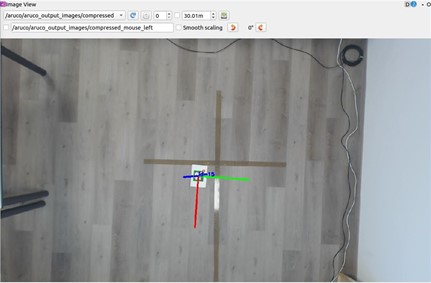
/aruco/aruco_output_images/compressedTo this topic will be published the output images. In this images the detected ArCuo Marker is highlighted and the pose is drawn using a coordinate system.


